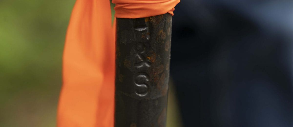
Boundary Pins Make For Good Neighbors
If you have ever walked your property line or wandered through a wooded area, chances are you’ve stumbled across metal stakes in the ground. These are known as boundary markers/pins or boundary monuments and are used to mark the corners of a property.
They are often iron pipes, bolts, or rebars driven three to four feet into the ground by the land surveyor who did the survey work on the property. These markers can often be seen on the land’s surface, but sometimes they must be found with a metal detector if they were set below grade. They are often capped with brightly colored plastic or aluminum and stamped to identify the surveyor that did the land surveying.
Why do I need Boundary Pins?
If you are thinking of installing a new fence, addition to your house, or maybe repaving your driveway, knowing your property boundaries is critical. Head off any potential disputes with neighbors by first determining your lot lines before any building takes place or tree trimming along the property line. Hiring the help of a professional surveyor is best when you have boundary questions.
If boundary lines are not fully outlined and marked, landowners can run into issues. The ramifications can be far-reaching and expensive.
Should I have my boundary pins reset?
Don’t assume your older piece of property has established boundary pins. Over time, the existing pins may get buried in the underbrush, knocked out of place, or removed. It is sometimes discovered that boundary markers are placed incorrectly. At times the surveyor may disagree with some of the existing pins, deeming them incorrect or irrelevant to the survey at hand.
Is it Illegal to remove property markers in Maine?
In short, yes! It’s illegal in Maine to disturb, remove or destroy a property monument or marker outlined in MRS Title 14, Waste and Trespass to Real Estate. If you suspect your boundary pins have been tampered with, you can contact a professional land surveyor to have them replaced in the proper location.
Boundary pins are part of the package!
When Herrick & Salsbury, Inc, conducts a survey, setting pins is typically part of the process. If you want to know exactly where your boundary is, it’s best to hire a professional land surveyor. We will review title documents and research the parcel deed and the deeds of your neighboring properties as well as visit the parcel to locate existing corner and boundary line marks. Once we have been able to correlate the deed descriptions of you and your neighbor’s parcels with the marks we find on the ground, we will return to your land and place markers at the corners of your property.
We use a variety of monuments;
- “H&S” (short for Herrick & Salsbury) embossed 1” diameter steel bolt. It is not uncommon for us to set our bolts in stones for added support where soils are shallow.
- Yellow or aluminum capped rebar with identification “Herrick & Salsbury, Inc”. stamped in the cap.
- 4”x 4” granite monument is a type of marker oftentimes requested for its visual qualities.
- Ship Spike & Railroad Spike are types of monuments that have been largely replaced by our capped rebars. Typically these spikes were set in ledge, but installation was timely as lead would be tamped around their base, filling voids where the action of the freeze-thaw cycle could cause a disturbance, a problem not encountered with rebar. Nonetheless, this type of monument can be found in our historical work throughout Hancock County, and can still be requested.
- Occasionally a tree is in the location of the monument we were planning to set. In these cases, we “spot” or scar the tree, identifying it as the monument.
Contact the team at Herrick & Salsbury, Inc. for help surveying your property! It might save you from costly litigation in the future.

